• About
  • Advertise
  • Careers
  • Contact Us
Saturday, June 21, 2025
  • Login
No Result
View All Result
NEWSLETTER
Tech | Business | Economy
  • News
  • Tech
    • DisruptiveTECH
    • ConsumerTech
    • How To
    • TechTAINMENT
  • Business
    • Telecoms
    • Mobility
    • Environment
    • Travel
    • StartUPs
      • Chidiverse
    • TE Insights
    • Security
  • Partners
  • Economy
    • Finance
    • Fintech
    • Digital Assets
    • Personal Finance
    • Insurance
  • Features
    • IndustryINFLUENCERS
    • Guest Writer
    • EventDIARY
    • Editorial
    • Appointment
  • TECHECONOMY TV
  • Apply
  • TBS
  • BusinesSENSE For SMEs
  • Chidiverse
No Result
View All Result
Tech | Business | Economy
No Result
View All Result
ADVERTISEMENT
Home DisruptiveTECH

Using AI to Map Africa and Beyond

Introducing the Open Buildings 2.5D Temporal Dataset -

by Peter Oluka
September 23, 2024
in DisruptiveTECH
0
Google Using AI to Map Africa and Beyond
Mapping Africa and Beyond

Mapping Africa and Beyond

UBA
Advertisements

Did you know that by 2050, the world’s urban population is expected to grow by 2.5 billion, with nearly 90% of that growth happening in cities across Africa and Asia?

To keep up with this rapid urbanisation, governments, humanitarian organisations, and researchers need accurate information on buildings and infrastructure.

This data helps plan for future growth, respond to crises, and ensure resources are distributed fairly. But in many parts of Africa and the Global South, this vital information is outdated or simply unavailable.

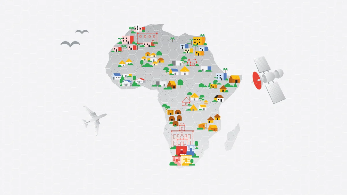
That’s why Google launched the Open Buildings project in 2021. It started at the AI Research Lab in Accra, Ghana, and has helped map 1.8 billion buildings across Africa, Asia, Latin America, and the Caribbean—about 40% of the globe.

This data has been used by governments, NGOs, and researchers to improve services and respond to disasters.

Real-world examples:

  • In Uganda, the nonprofit Sunbird AI used our data to prioritise areas for rural electrification, ensuring that towns and homes most in need received power first.
  • WorldPop, a team from the University of Southampton, has integrated the Open Buildings data into their population estimates. These estimates are being used by UN agencies and governments, including in Nigeria, where the data has helped identify areas where children haven’t received routine immunizations.

Now, we’re expanding this effort with the Open Buildings 2.5D Temporal Dataset, which doesn’t just map buildings—it shows how they change over time and estimates their heights.

This new data covers the years 2016 to 2023, offering a detailed picture of how cities and settlements across Africa and the Global South have grown.

This is crucial for urban planning, disaster response, and understanding population density.

Governments and organisations can use this data in various ways:

  • Flood preparedness: In flood-prone areas, accurate data can help authorities predict which buildings and neighbourhoods are most at risk.
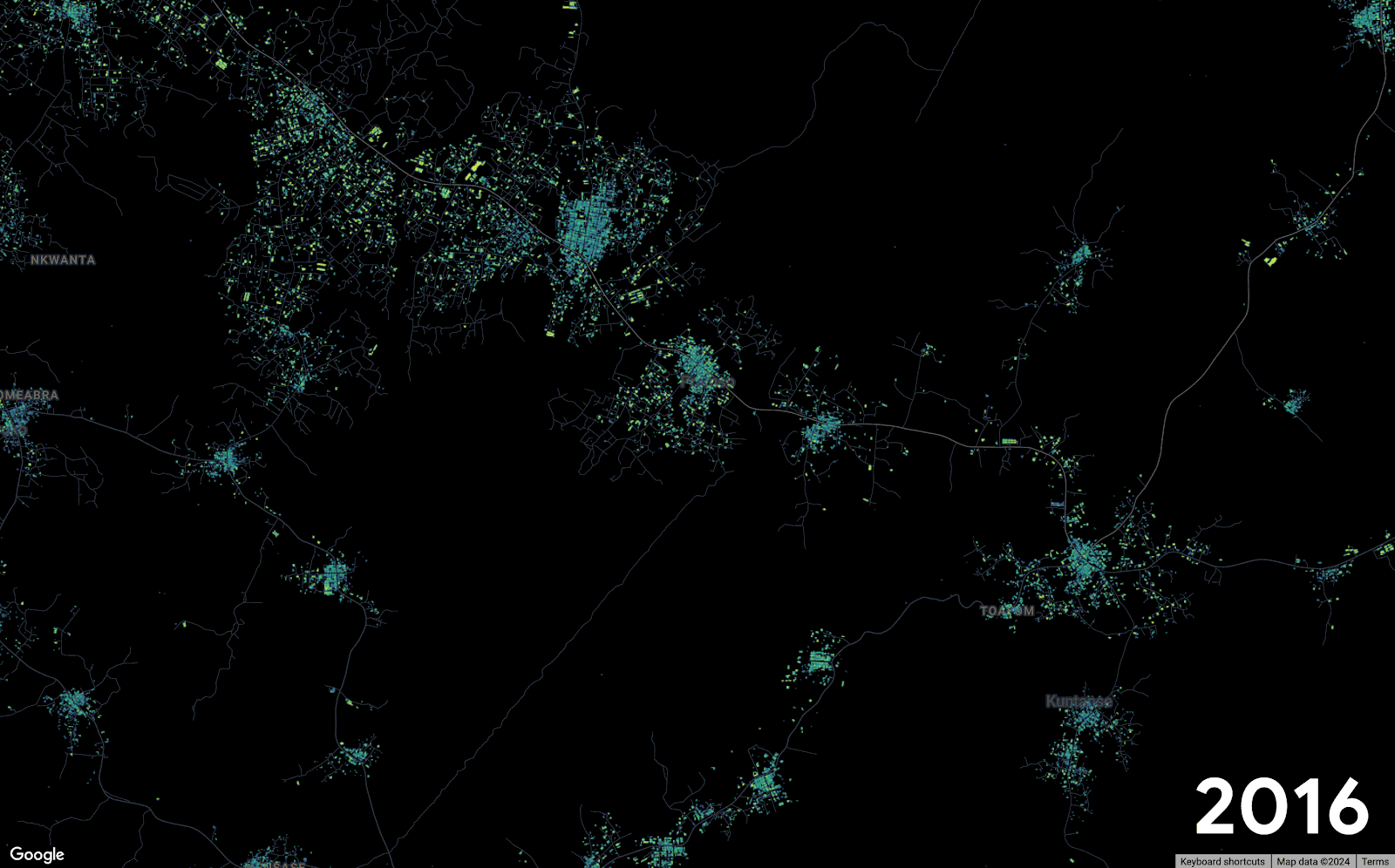
  • Urban growth: In cities like Kumasi, Ghana, which has seen rapid expansion, this data allows city planners to better manage resources and infrastructure.
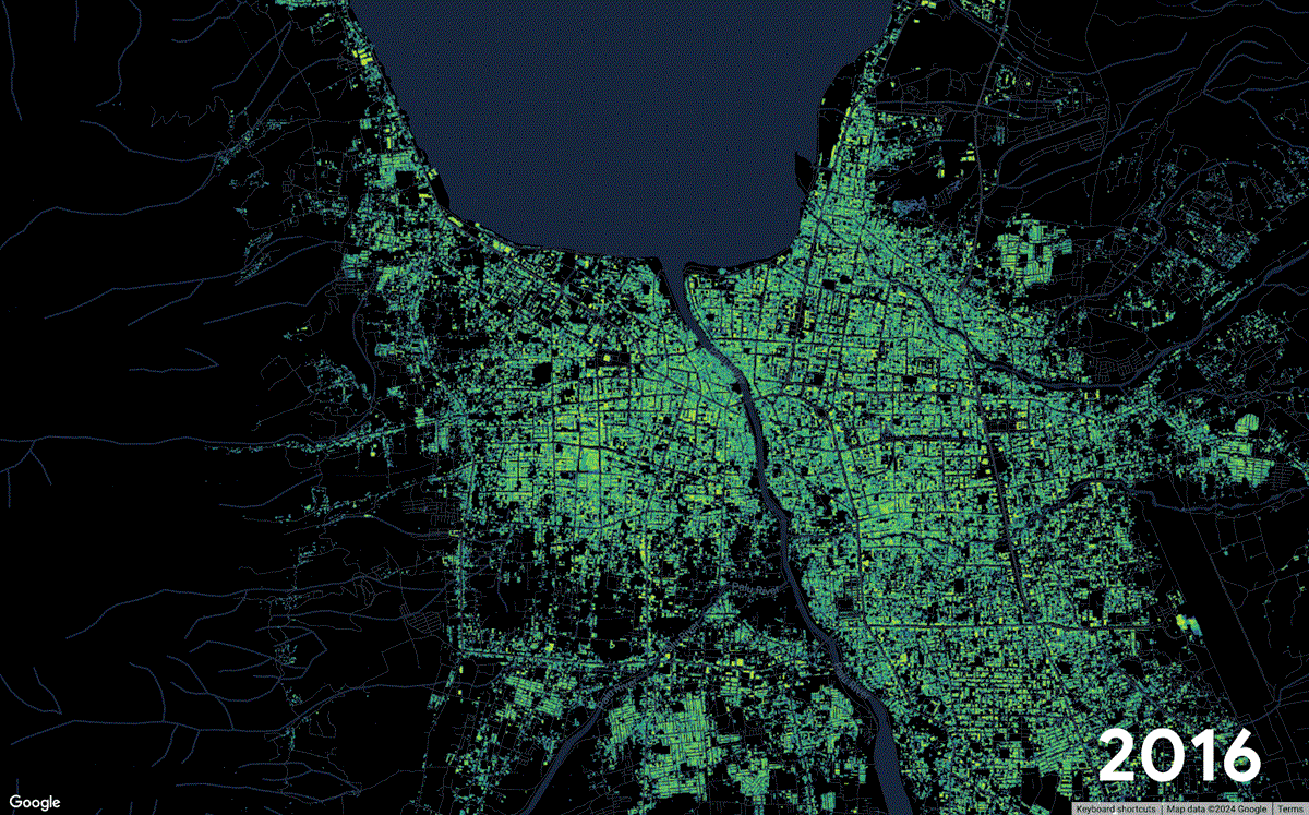
  • Disaster recovery: In places like Palu, Indonesia, where a tsunami struck in 2018, this data shows how the built environment changed before and after the crisis, helping rebuild communities more effectively.

How we built this dataset:

We used AI to improve the quality of low-resolution satellite images and estimate the size and height of buildings.

This is important because higher-resolution satellite images are not always available for the Global South.

With this technology, we’ve created a detailed map of over 58 million square kilometres, covering parts of Africa, Latin America, South, and Southeast Asia.

Why this matters:

Maps are a lifeline. They help governments, humanitarian agencies, and researchers ensure that everyone is counted and represented.

With this new dataset, we’re giving these organisations better tools to plan for the future, respond to crises, and support communities in need.

We invite researchers, policymakers, and anyone interested in urban development to explore the Open Buildings 2.5D Temporal Dataset on Google Earth Engine and share their feedback with us.


Using AI to Map Africa and Beyond
Advertisements
MTN ADS
Pramso, Ghana: Ghana’s urban population has more than tripled in the past three decades. Kumasi, Ghana’s second largest city, has seen lots of growth over the past few years. Here, we see rapid growth in Pramso, a village on the outskirts of Kumasi.
Using AI to Map Africa and Beyond
Palu, Indonesia: On 28 September 2018, a 7.4 magnitude earthquake off the coast of Indonesia triggered a tsunami, affecting around 1.5 million people on the island of Sulawesi. After this crisis, the built area recedes from the coastline, and the effects of the earthquake are visible in the data.   [Featured Image Credit]

Loading

0Shares
Tags: AI and MapGoogle Earth EngineNGOsOpen Buildings 2.5DTemporal Dataset
Peter Oluka

Peter Oluka

Peter Oluka (@peterolukai), editor of Techeconomy, is a multi-award winner practicing Journalist. Peter’s media practice cuts across Media Relations | Marketing| Advertising, other Communications interests. Contact: peter.oluka@techeconomy.ng

Next Post
WTTC, tourism, travel, airlines, Doha, Qatar

WTTC Reveals Pandemic’s Heavy Toll on Woman, Youth in Travel & Tourism Jobs

Leave a Reply Cancel reply

Your email address will not be published. Required fields are marked *

I agree to the Terms & Conditions and Privacy Policy.

This site uses Akismet to reduce spam. Learn how your comment data is processed.

Recommended

OpenAI to Cut Microsoft’s Revenue Share

OpenAI to Cut Microsoft’s Revenue Share from 20% to 10% by 2030

2 months ago
SchoolX

Bridging the Gap: The Importance of Platforms like SchoolX in Nigerian Education

1 year ago

Popular News

    Connect with us

    • About
    • Advertise
    • Careers
    • Contact Us

    © 2025 TECHECONOMY.

    No Result
    View All Result
    • News
    • Tech
      • DisruptiveTECH
      • ConsumerTech
      • How To
      • TechTAINMENT
    • Business
      • Telecoms
      • Mobility
      • Environment
      • Travel
      • StartUPs
        • Chidiverse
      • TE Insights
      • Security
    • Partners
    • Economy
      • Finance
      • Fintech
      • Digital Assets
      • Personal Finance
      • Insurance
    • Features
      • IndustryINFLUENCERS
      • Guest Writer
      • EventDIARY
      • Editorial
      • Appointment
    • TECHECONOMY TV
    • Apply
    • TBS
    • BusinesSENSE For SMEs

    © 2025 TECHECONOMY.

    Welcome Back!

    Login to your account below

    Forgotten Password?

    Retrieve your password

    Please enter your username or email address to reset your password.

    Log In
    Translate »
    This website uses cookies. By continuing to use this website you are giving consent to cookies being used. Visit our Privacy and Cookie Policy.