

| By: Francis Onyemachi
Artificial intelligence is changing how businesses and institutions operate, but another powerful technology is quietly working alongside it.
Through the combination of AI with satellite imagery and location data, geospatial intelligence is helping businesses, institutions and governments make smarter decisions and improve productivity.
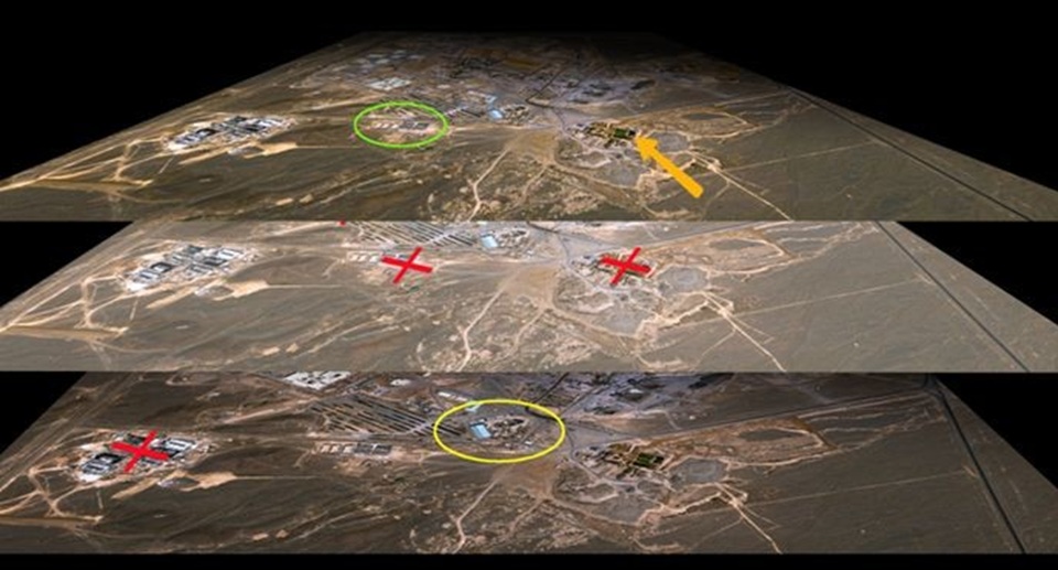
Geospatial intelligence (GEOINT) is intelligence derived from the exploitation and analysis of imagery, signals or signatures with geospatial information. It describes, assesses and visually depicts physical features and geographically referenced activities.
According to experts, geospatial intelligence is already transforming business operations and can unlock significant opportunities across financial services, agriculture, public sector planning, logistics and other sectors.
A research scientist, Dr. Kappo Ayodeji, speaking during a live appearance on BusinessDay Television today, described geospatial intelligence as location-based intelligence that combines satellite imagery with technologies such as GPS and drones.
According to him, geospatial intelligence is becoming a crucial tool for businesses seeking to improve operational efficiency, reduce costs and make better investment decisions.
“Geospatial intelligence is just local intelligence. And it deals with just three aspects. That is the GIS itself, and that’s the system that collates all spatial data. What I mean by geospatial is basically anything that has space. So it’s just space and technology. And you can agree with me that everything that we are here on Earth is based on space.
“It is simply integration of data together. It uses past data, and you need to predict what the future data will be. So it can tell you customer patterns, how customer patterns are changing, where is the best location to site your business so that you can have a better, more robust and flexible business that will satisfy demand and also increase your profit margin,” Kappo said.
He noted that while artificial intelligence has become widely recognised, geospatial intelligence remains less understood despite its growing role in business and government decision-making.
According to him, geospatial intelligence relies on technologies including satellites, drones and the Global Positioning System (GPS), which generate location data that can be integrated with artificial intelligence to support predictive analysis.
Sectors Likely to Benefit from Geospatial Intelligence
Kappo said every sector of the Nigerian economy has the potential to benefit from the technology but highlighted agriculture, fintech and logistics as industries that are particularly well positioned to unlock new opportunities.
“With integration of GIS, farmers can know the right place in which to site their crops. You agree with me that we’re having challenges with climate change. But with this technology, they can know the best time to plant.
“It also determines the crops, the moisture content and helps them identify areas that are flood-prone, so that they know what kind of crops to plant there,” he said.
On logistics, he explained that companies have already embraced location intelligence to improve route planning, reduce travel time and lower operating costs.
According to Kappo:
“They are able to have better efficiency, they’re able to reduce their costs because the time spent wasting in traffic has been limited. They also reduce wear and tear on vehicles, thereby increasing their lifespan.”
Speaking on fintech, the expert explained that firms increasingly rely on geospatial data and artificial intelligence to assess customers and make lending decisions.
“With all these fintechs, they’re able to use GIS, which is your location, to know where you’re most frequent. They have a database of all your systems.
“They generate and analyse your credit history and transactions within a short time and determine how much you have been able to transact, your turnover. With that, they can generate a predictable amount they can lend to you. And that’s what most of the loan apps are already using,” he said.
Helping Businesses Make Smarter Decisions
According to Kappo, combining artificial intelligence with location data enables businesses to better understand customer behaviour, optimise inventory and identify profitable business locations.
“Artificial intelligence can analyse massive amounts of data. It can help you analyse historical trends in inflation, customer spending patterns and put all this information together, which can help determine how best to serve customers.”
He explained that businesses can combine multiple layers of information, including road networks, population density, mobile traffic and consumer spending patterns, to make more informed commercial decisions.
Need to Deepen Adoption
Despite its potential, Kappo identified gaps in awareness, infrastructure and digital literacy, noting that addressing these challenges is essential to maximise the benefits of geospatial intelligence.
“The technology is actually advanced and Nigeria needs to embrace it. While we have infrastructural gaps, it cannot be limited by development. Human beings must always develop. Just as we leapfrogged from wanting to give every community landlines to mobile technology, similar progress can also be replicated in AI and geospatial technology,” he said.
He added that many useful datasets are already publicly available but that more education is needed to help businesses and citizens understand how to use them effectively.
Kappo also urged policymakers to invest in digital skills, make more non-sensitive government datasets publicly accessible and support local innovation to ensure Nigeria remains competitive in the AI and geospatial economy.